SARASOTA – You may have heard people talk about “the new normal” after the COVID pandemic is over. But you won’t have to wait long until “the new normal” of weather.
Record heat and record hurricane seasons raise this question – what does it mean to have an average year? The National Oceanic and Atmospheric Administration, or NOAA, is answering that question.
When you hear a meteorologist talk average temperatures, as in, “We hit 79 for a high, and our average is 80,” we’re using a 30-year climate period – 1981 to 2010. Every 10 years, this gets updated. That means that now, the average period will be from 1991 to 2020.
Starting in May, we’re removing the 1980s, which weren’t as warm as the 2010s, and our average temperature with this new data goes up with it. That doesn’t apply to everyone – the Dakotas, Minnesota, and other states will be comparing their weather with a cooler average high, with a few exceptions.
Here’s the kicker: because what’s considered the seasonal average will be getting warmer, we’ll likely not see as many “warmer-than-average” days because our highs and lows will have to be warmer in order
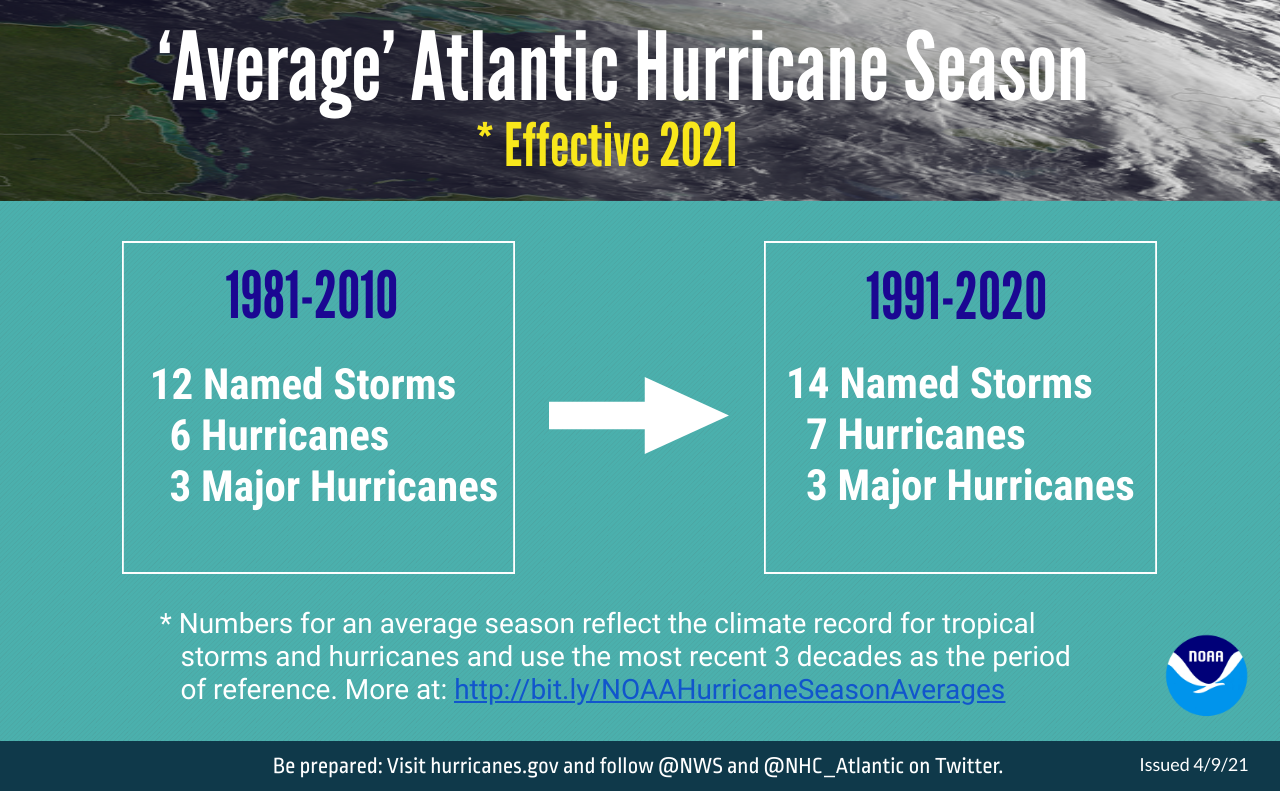
An average hurricane season, however, will be considered more active. This follows some extremely active seasons, including the record 30 named storms in 2020. So because your seasons have been more active, the average season is considered more active.


